Unleashing the Power of FreeMap: Your Gateway to Stunning Map Visualizations
Welcome to FreeMap Online, a cutting-edge platform designed to revolutionize the way you interact with spatial data. Whether you're a map enthusiast, a data scientist, or just someone curious about the world, FreeMap opens up a world of possibilities for exploration and analysis.
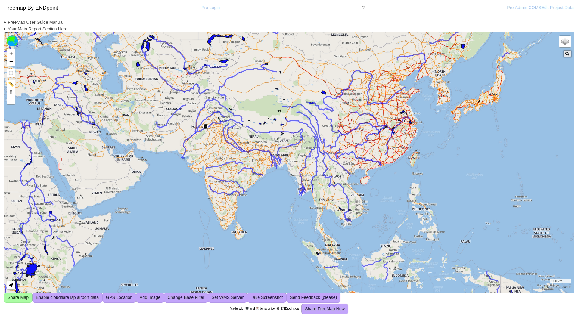
Today, let’s break down the elements that create this beautiful, feature-rich map visualization, highlighting the components and data sources used.
What Makes FreeMap Special?

1. Dynamic Base Maps
FreeMap leverages the precision and detail of Location IQ’s base maps, providing a high-quality foundation for any map visualization. This ensures:
- Crisp and detailed street-level views.
- Seamless integration with overlays for richer contexts.
2. Real-World Infrastructure
We integrate data from Open Railway Map, showcasing global railway networks in stunning detail. Rail infrastructure data brings valuable insights for logistics, travel planning, and infrastructure analysis.
3. Natural Earth’s Rivers and Lakes
The addition of Natural Earth’s rivers and lakes datasets enriches the map with natural features, helping users visualize hydrological patterns and their impact on human activity. These datasets include:
- Rivers and lake centerlines for tracing the world's waterways.
- Populated places for pinpointing urban centers.
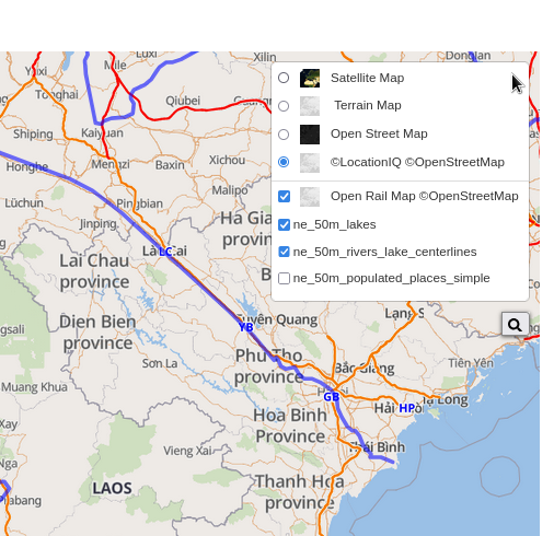
4. Layer Control for Customization
FreeMap empowers users with intuitive layer control. Add, toggle, or modify map layers such as rivers, lakes, or railways to tailor the map to your exact needs. 👉 Click here to explore FreeMap Online
Seamless Interaction and Tools
FreeMap isn’t just about displaying data—it’s about giving you the tools to engage with it:
- GPS Location Tools: Quickly locate yourself and start exploring.
- Custom Layers: Upload GeoJSON files and see them rendered in real time.
- Image and Report Integration: Add screenshots or feedback directly to the platform for easy collaboration.
Why FreeMap?
FreeMap Online isn’t just another mapping tool—it’s a gateway to understanding the world. With a clean interface, powerful customization options, and integrations with high-quality datasets, it’s designed to make mapping accessible, actionable, and fun.
Try FreeMap Now!
Want to experience FreeMap yourself? Dive into the world of spatial data and discover what makes FreeMap unique.
👉 Click here to explore FreeMap Online
Whether you’re mapping rivers, visualizing infrastructure, or just exploring, FreeMap is the platform to do it all. Start your journey today! 🌍
